
The Mount Waterman loop is two different experiences wrapped into one. A typically serene stroll through the high elevation forests of the San Gabriels is combined with a tour of a defunct ski resort slowly decaying as global warming redefines expectations for Southern California’s winters.
Trail Details
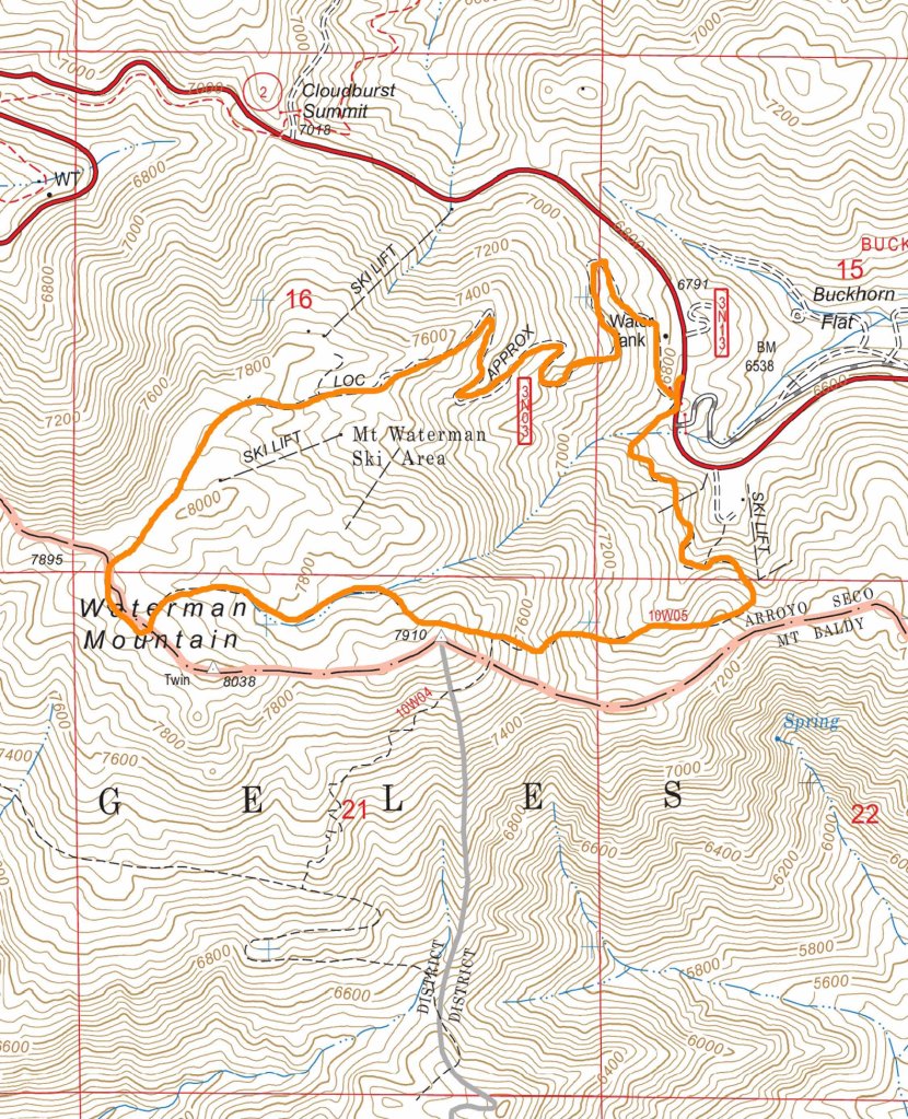
Mileage: 6.3 miles
Elevation Gain/Loss: 1250 feet
Day(s) Hiked: 12/16/13
Trailhead Location
Dog Friendly: Yes
Trip Report
Walking alone in the woods amongst the torn up lift map sign, boarded up buildings, and rusting chair lifts, it is easy to jump to the conclusion that this ghost resort is cursed. It’s not necessarily that big of a leap either. Since I moved to LA a decade ago, the Mount Waterman ski resort has been in operation for four out of the ten winters that I’ve lived here. Red tape with the forest service kept the resort out of operation from 2001-2008, the Station Fire eliminated road access for most of the 2009-2010 season, and dry warm winters have prevented it from operating for the past two winters. So far, this winter has not had a promising start for those hoping to return to the slopes anytime soon this season, and future climate models do not paint an optimistic outlook for the future of the resort.
The Mount Waterman loop is a popular way to see the mountain when it is not in operation. Going in a clockwise direction, it begins with a beautiful shaded trail through the remote interior of the San Gabriels, where there is no indication that you are hiking next to a ski resort. The start of the trail is actually not at the Mount Waterman chairlift pictured above, so don’t make the mistake of trying to start there. The trailhead starts across the street from Buckhorn Flat a couple hundred yards down the road. Look for these signs for the start of the trail.

The trail quickly ascends enough to give some nice views of the surrounding mountains on the more exposed sections.

For the most part though, it remains in the forest and the views are limited to the trees surrounding you, which is fine by me. Living in LA and hiking in so many previously burned areas, I’m a little tree starved. Callie doesn’t seem to have a preference.


After about a mile and a half, the trail approaches the ridge line of the mountain range and views towards Los Angeles begin to open up.

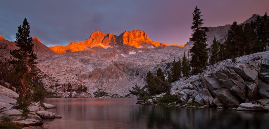
The most impressive view from this spot is towards the east where Mount San Jacinto towers in the background.

Since we were hiking this trail on a Monday in December, we didn’t see anyone for the entire day. The constant ringing of Callie’s bear bell was replaced by a dead silence whenever we stopped to take a break. Crossing a number of these prints in the snow, which I believe are Mountain Lion tracks, suddenly gave me pause and had me scanning my surroundings much more than usual.

The trail gradually climbed the ridge towards the flat summit of Waterman, while Callie and I kept a watchful eye on our surroundings.

The summit of Waterman, like so many peaks in the area, is a pretty flat, uninspiring spot without any clear views. However, if you explore the area, you will find some rocks that you can scramble up on to get an unobstructed view of the area. The main attractions from this viewpoint are the Twin Peaks summits directly in front of Waterman. These peaks are accessible from this trail, and they were our original destination for the day but a late start didn’t give us enough time to tackle the longer hike. I guess I’ll just have to come back, ah shucks.
The air was amazingly clear and we could clearly see the Channel Islands, San Jacinto, and Mount Baldy at the same time. Days like this are pretty rare in LA, and every time I’m out on the trail on one of them it feels like I won the lottery.


Callie’s spirits were soaring as well, as they always do when we hike in the snow. Since we were doing a shorter hike, I took advantage of the leisurely pace and allowed for some extra breaks to let her play in the snow. Watching Callie do her snow ritual never gets old to me.


Once playtime was over, we began to descend the fire road from the summit area. When hiking the loop, one way to the summit is entirely trail, while one way is entirely fire road. While hiking on a fire road is clearly less enjoyable than a well maintained single track trail, it does have a few advantages. For one, the forest is more thinned out which provides more consistently open views of the surrounding area, which in this case are quite nice. If there were more snow on the ground, this route would be considerably safer as well.

The fire road passes right through the heart of the ski resort. It is a pretty creepy sight, especially when hiking alone and being stalked by mountain lions in your mind. Pay some attention to the lift map, as there are actually a bunch of fire roads in this area. My Tom Harrison trail map showed only one fire road, which made things confusing here. I ended up just sticking to the left which worked out.

The fire road passes right through most of the ski resort and then returns to familiar mountain landscape as it descends back to the trailhead.

Another nice thing about hiking Mount Waterman is that you get to drive on the beautiful Angeles Crest Highway to get there. If you are blessed with a clear day like we were, then you can stop by Mount Wilson on your drive home to get one of the best sunset views of Los Angeles. We got pretty lucky this time. A gorgeous sunset blazed over Los Angeles, which reflected off of the ocean clearly seen from 30 miles away. Simply amazing.


Love Callie’s romp in the snow!
Thanks Yvonne! It made me realize that I need to do that more often. So cute!
You are indeed lucky to have such a faithful hiking companion.
Thanks William, she is a pretty special dog indeed.
Is your blog “Cali Trails” or “Callie Trails?” 😉
HJ
Haha, the name is not a coincidence Jim. We all know who the star of the show is.
Great post. If you think Waterman is creepy, pull over and check out the old Kratka Ridge resort a mile or so up the road. It’s in even more disrepair and has been completely trashed. It’s sad to see local skiing go the way of the dodo and I hope remnants of both places survive so hikers can check them out.
I noticed that Callie doesn’t wear boots. Do you use a cream on her paws or has she had any injuries?
Great post
We carry some booties for emergency purposes, but have never used them. We don’t use any cream either, except for a product called Mushers Mix which we use on all day snow hikes.
So far, no injuries yet. Callie’s paws are naturally pretty tough and we try to get her out on rough trails on a regular basis to keep them that way.
Pingback: Three Points to (almost) Twin Peaks | CaliTrails