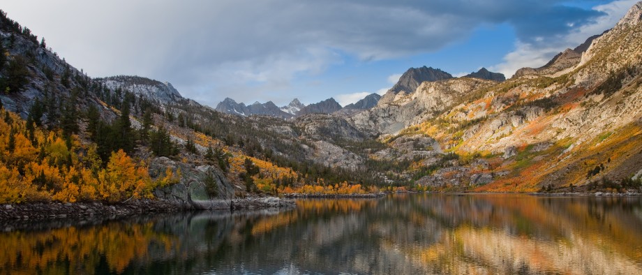

Tucked away on the northern side of the San Gabriel mountains, the Devil’s Punchbowl is one of LA’s best kept secrets. The juxtaposition of mountain scenery with desert geology gives it the type of rich diversity that defines California’s landscape.
Trail Details
Mileage: 7.4 miles
Elevation Gain/Loss: 700 feet
Day(s) Hiked: 3/23/14
Trailhead Location
Dog Friendly: Yes

Trail Guide
Unless you live in the Antelope Valley, the Devils Punchbowl is a bit of a drive. Getting there from LA requires going to the northern side of the San Gabriels via highway 14 or 15, and then heading towards the center of the mountain range via a slew of surface streets. Approaching the park, there are practically no signs helping point the way. So, a good map or GPS is a must if you want to find this place.
Once you get there, you might be amazed at how many people are at the park considering how remote the area feels. Don’t worry though, the majority of people who visit the area stick to the one mile nature loop that stays close to the visitor center, giving the Devil’s Chair trail plenty of solitude.
The first part of the hike is pretty unexceptional. The route goes up a fire road for .9 miles of monotonous hiking as it heads up the base of the mountain to the edge of the forest. The upside is that the road gives occasional glimpses down into the Punchbowl, and each view is a little different than the last due since the hike circumnavigates the Punchbowl. Changing angles just a little bit can result in the scene looking completely different.

After .9 miles, the road intersects with the Burkhart trail, which goes nine miles all the way up to the Angeles Crest Highway. From the junction, the Devil’s Chair trail begins, and the environment shifts from low to high desert. The trail begins to skirt the border of the alpine forest while not so distant snowy peaks line the background.
This is about as high as the hike gets. As it goes eastward across the slope, it descends and ascends a bit in and out of a few canyons, but for the most part the trail is remarkably flat, hovering around 5,000 feet.


Most the trail is exposed to the sun, although there is always a shady spot close by if you need one. The one advantage of an exposed trail is the open views that it provides, and in this case, the sweeping expanse of Antelope Valley is brought into clear view.


For the middle section of the trail, there isn’t much of a sight line of the Punchbowl, but as you approach the Devil’s Chair, it begins to reveal itself in new perspectives.

You might want to keep a close eye on the trail while you’re walking though.


The occasional forested stretch is an extremely nice change of pace from the rest of the hike. Even on a cool day where the shade is merely a luxury, the variety of sights and sounds from the contrasting environments provides a much richer experience.


The last section of the trail dips down a few hundred feet into the gorge to reach the Devil’s Chair. It’s the steepest part of the hike, but it’s pretty short so it’s not too bad on the way back up.

During the final approach, the location of the Devil’s Chair presents itself at last. It sits on top of a tall beige cliff overlooking a valley full of fractured tan rock. This area is at the border of three different fault lines, and the result is an abundance of uplifted sedimentary rock that dots the landscape in an intricately beautiful formation.


The last stretch is lined with guard rails, which taints the natural beauty of the scene but is understandable given the exposure of the trail and popularity of the destination.


The trail ends with an incredible unobstructed view of the Punchbowl. Soak it in, because this is the end of the line.

Fortunately, that means the hike is only halfway over because I cannot emphasize how relaxing this trail is.


That looks like a fantastic trail!
You are a brave bunch for hiking to a 3-point fault zone during these times! 😀
Haha! We did this hike about a week before all of the quakes started up, otherwise I probably would have had similar thoughts. What a crazy place to be when the big one hits.
Is this trail hikeable in the winter? Say about, tomorrow 1/14/2015?
Yes, it’s hikable in the winter. Tomorrow would be a great day to hike it. Summertime is the one time of year that I would not recommend this trail since it can get quite hot during a heat wave.
If you hike this trail right after a winter storm, you can even get the benefit of seeing the mountains covered in snow. Have fun!
Cool, thanks for the quick response! Any tips on where to check for road closure due to snow, etc? We’ll be heading that way from Long Beach.
I can’t think of anywhere along the way where road closure would be an issue. The Angeles Crest Highway closes down in the winter time, but you shouldn’t need to use it to access this trail.
You will need to go around the San Gabriel mountains to get to the North Side. To do this, take the 14 from the west side, or the 15 from the east side.