
The Chain Lakes in the southwestern area of Yosemite National Park is an easy place to achieve some solitude in one of America’s busiest parks.
Trail Stats
Mileage: 12 Miles Round Trip
Elevation Gain: 1200 Feet
Day(s) Hiked: 8/21/10 > 8/22/10
Trailhead Location
Dog Friendly: No

Trail Guide
In the foothills east of Oakhurst, CA, there is a network of dirt roads that access a multitude of remote Sierra Nevada trailheads. Getting a 2WD car up to these trailheads would be difficult, but probably doable. Our Subaru Outback made it up without any issue.
From the Quartz Mountain trailhead, the Chain Lakes are an easy 6 mile hike with about a thousand feet of elevation gain.

Despite the easy hiking, this area is fairly empty due to how difficult the trailhead is to access, which makes it a perfect place to show some newbies the Sierra Nevada backcountry.
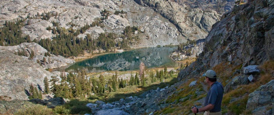
Once you get up to the second Chain Lake, the scenery opens up in all directions.

There are a few choice campsites, and thankfully you can have campfires since you are right below the 9,600 foot elevation line. From here, you can easily access the rest of the beautiful lakes and surrounding area.


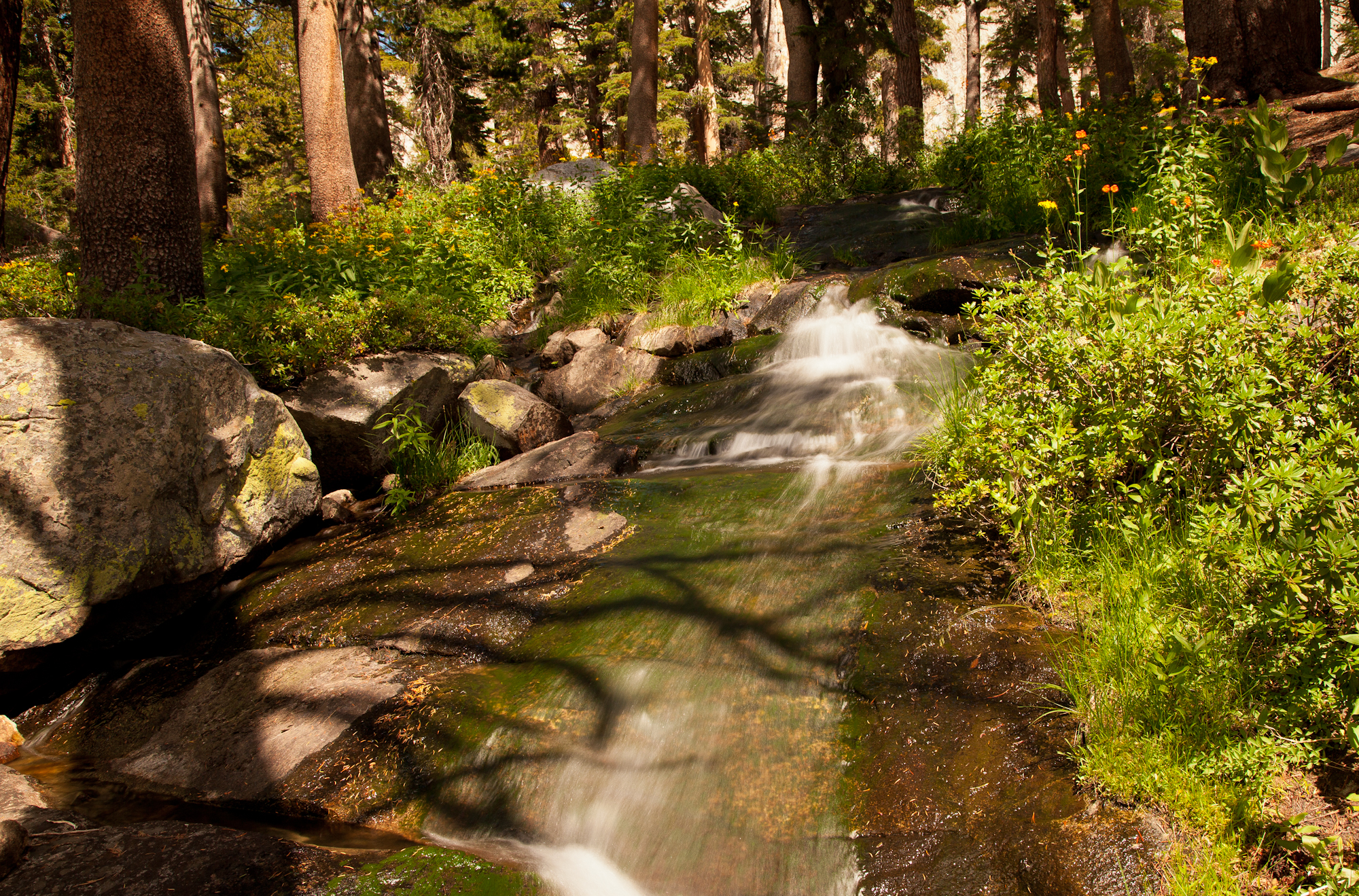
During our visit in August, a stream flowing out of the third lake was surrounded by a brilliant wildflower display.
The trip was highlighted by one of the most remarkable sunsets we’ve ever seen. Gale Peak glowed so much that it looked fake. Looking the opposite direction towards camp, the sky was striped with the most saturated colors imaginable over a seemingly endless expanse of granite beauty. This is what backpacking in the Sierra is all about.


So much jealous.
Looks like a great hike and trip. I’m adding it to my todo list! Where did you get your permit at? Was there a quota?
You reserve the permit through the Sierra National Forest. You can pick it up in Oakhurst, or a few other spots.
I’m not sure about the quota and I can’t find any info for that online. I think there is a quota, but I don’t think it fills up very often.
Thanks for the quick reply. I certainly look forward to getting up there some day!!
15 is the quota
Great photos and processing! As Subaru Outback owner, also good to know I can reach this trailhead. I’ve long been curious about the area but usually end up in Eastern Sierra.
Has anyone ever done this hike in early spring? I’m thinking about heading up in April sometime.
I have done the hike several times. The springtime is limited by the snow on Sky Ranch Road. We went in early May this year and day-hiked middle Chain Lake. There were patches of snow on the road but it was passable. I have been up there in mid-June and not been able to get to the trailhead in a Jeep. There was quite a bit of snow left at the lake but it was melting rapidly.
Didnt see any dogs in the pic. Dog friendly? I love the idea of offroading a little to get to a trailhead.
That is a negative. This trip goes into Yosemite, and like all National Parks, dogs aren’t allowed on trails there unfortunately. It’s right on the border of the park, so there are some nearby trails that are dog friendly in the Sierra National Forest. Check out some trails out of the Clover Meadow trailhead. I have never been in that area of the Sierra, so I cannot comment on how the scenery compares to the chain lakes area, but from my experience the Sierra very rarely disappoints. It’s on my list.
Actually, the fire line in Yosemite is 9,600 feet, not 10,000.
Thanks! I had forgotten the specifics as this was our last trip to the Yosemite Backcountry and I posted this a few years after the trip. Fortunately, the lakes are below the 9600 foot line.
Thanks for the awesome pics and trail description! Can’t wait to make this trip. Wanted to add some info for those wondering about dog-friendly trails in the same general area: the nearby trailheads Fernandez, Norris and Granite Creek all offer similar Sierra beauty and lakes (Vanderberg, Lillian, Stanford, Jackass, Cora, to name a few) with the added bonus of allowing Fido along, since they are all just outside of the Park in the Ansel Adams Wilderness 🙂
For those who don’t mind walking a little further, there is a trailhead that is MUCH easier to get to with a normal car. The Chiquito Pass trailhead is only 2 miles off of Beasore Road. It is pretty flat and there are no huge rocks to avoid. It is 3 miles from the trail head to Chiquito Pass. That adds about 2 miles one way compared to the Quartz Mountain Trailhead.
Did you do any fishing in the lakes or streams in the area?
Nope, but I believe that there are fish in all of these lakes.
Yes I did. The upper lake had plenty of fish, both times I went