
A day of solitude surrounded by miles of untouched wilderness and snow capped peaks, all contained in a Sunday hike in LA’s backyard. Even I didn’t think that was possible.
Trail Stats
Mileage: 12.5 Miles
Elevation Gain/Loss: 3500 Feet
Day(s) Hiked: 12/14/14
Trailhead Location
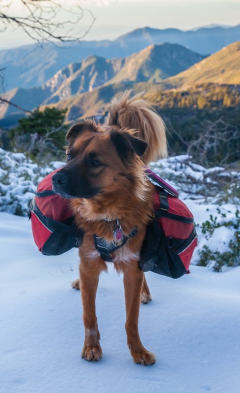
Dog Friendly: Yes
Trip Report
Editor’s Note: Winter hiking in the backcountry in very dangerous. Please do no attempt to replicate this hike without the proper experience and equipment.
In the dawn light of a crystal clear Sunday morning, Callie and I drove into the Crystal Lake campground to find an empty parking lot at the trailhead. Even though our arrival was fairly early, this was a bit of a surprise given the recent snowfall that had blanketed the area. Snow in the San Gabriel mountains is not an unusual occurrence, but it usually does not linger on the front slopes for more than a few days, so it’s important to take advantage of the short windows of opportunity that open up each winter.
It was the perfect excuse to get us out on the trail after a hiatus from hiking our local mountains. The arid landscape, parched from three years of drought, and persistent heat waves of summer had removed any desire to spend a day in the San Gabriel mountains. All it takes is one big snowstorm for that to change, and as luck would have it we got our first one of the season last weekend.
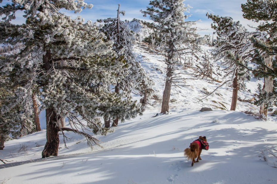
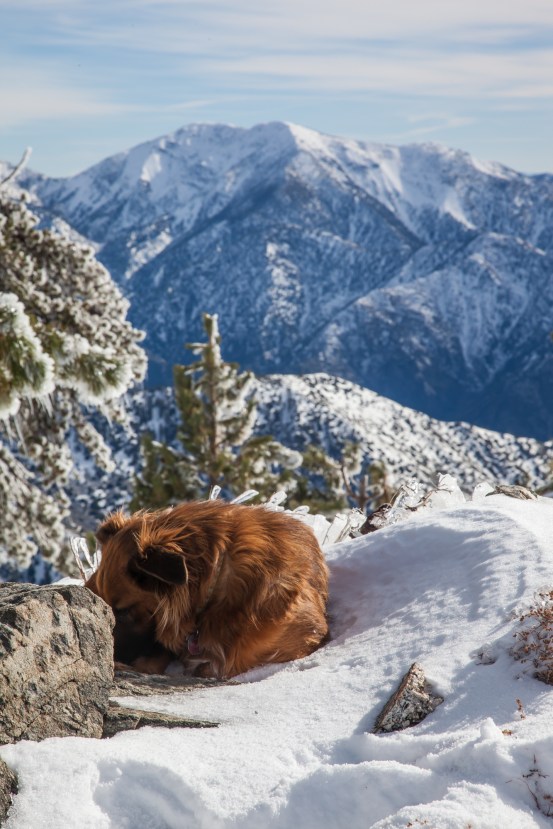
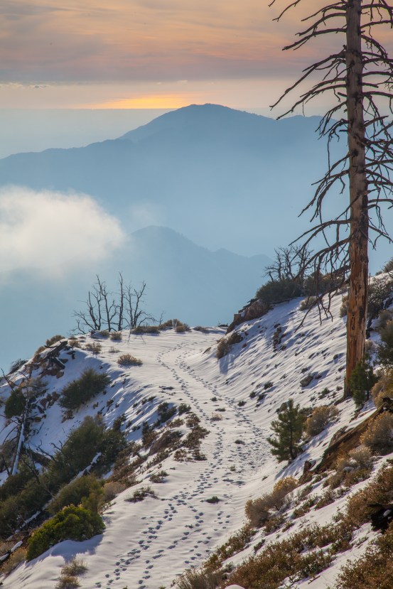
By the time we left the parking lot and started on the trail towards Windy Gap, the trail was already dusted with a bit of snow. Fortunately, hikers from the previous day had laid down the path and compacted the snow, which made the hiking much easier on us all the way to Windy Gap. This also meant that our entire day would be in the snow, which would be a tough test for Callie’s paws. She was up for the challenge though, appearing unusually focused considering we were hiking in fresh snow. In the end, I’d be the one hobbling down.
We’ve covered the trail up to Windy Gap on a previous post focusing on the Mount Islip loop. It’s a beautifully constructed trail that ascends up the PCT and gives you fantastic views of the Crystal Lake basin along the way. The big downside to the area is that the landscape is still struggling to recover from the 2002 Curve Fire. Twelve years later, many areas of the basin are still covered with little more than lines of dead trees, and it appears doubtful that the landscape will ever grow back into the forest that hikers used to enjoy here.
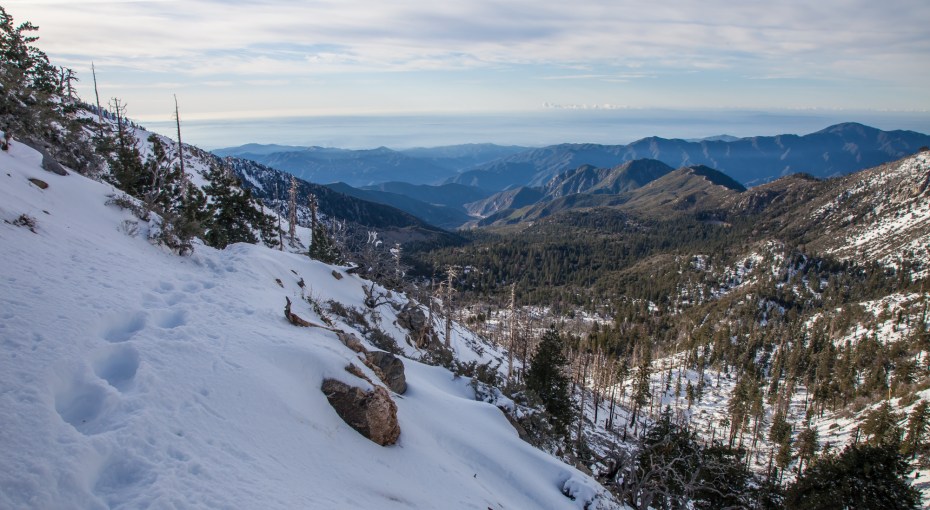
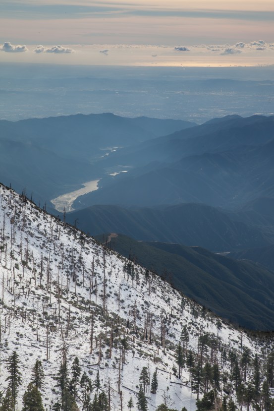
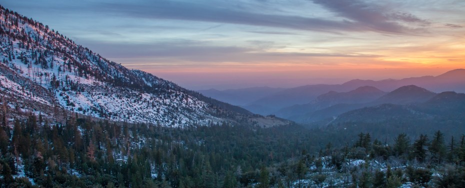
If you are a glass half full type of person, the lack of trees allows for some impressive views down to Los Angeles and the Pacific Ocean. We were hiking after a storm, so our views were about as good as you ever get in Los Angeles with the ocean clearly visible about 50 miles away from us.
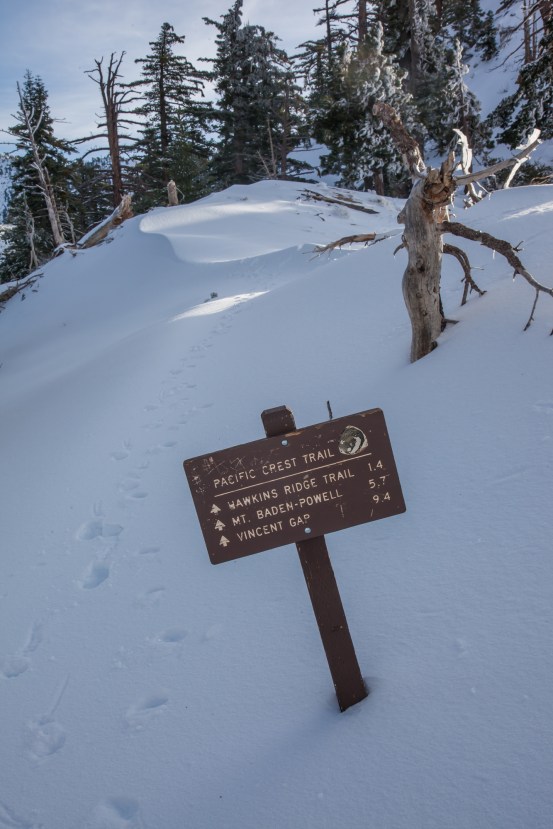
Upon reaching Windy Gap, we reached the Pacific Crest Trail and then took a right towards Hawkins Ridge and Mount Baden Powell.
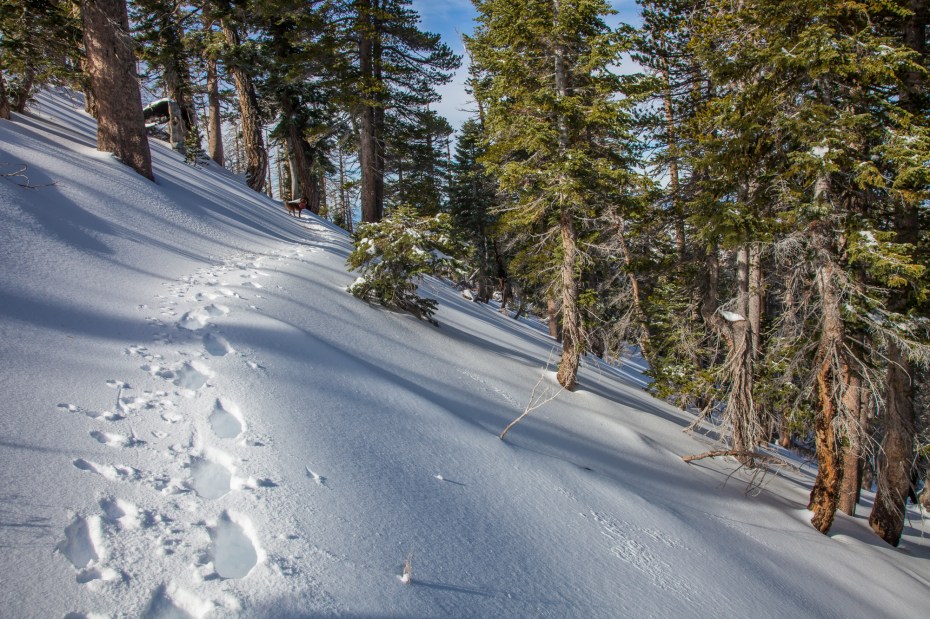
I was surprised to see that someone the previous day had also trekked down this stretch of the PCT, which make my going somewhat easier. The fresh show here was quite deep, and the snow was crusty and heavy which made it very tiring to trudge through.
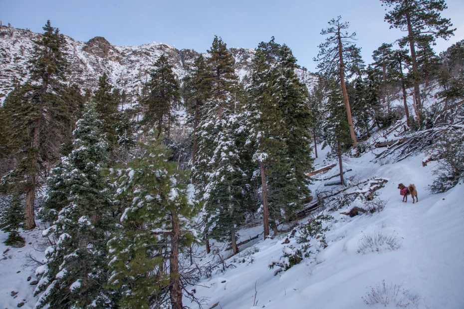
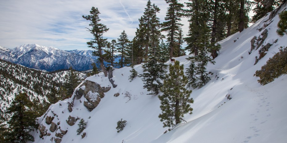
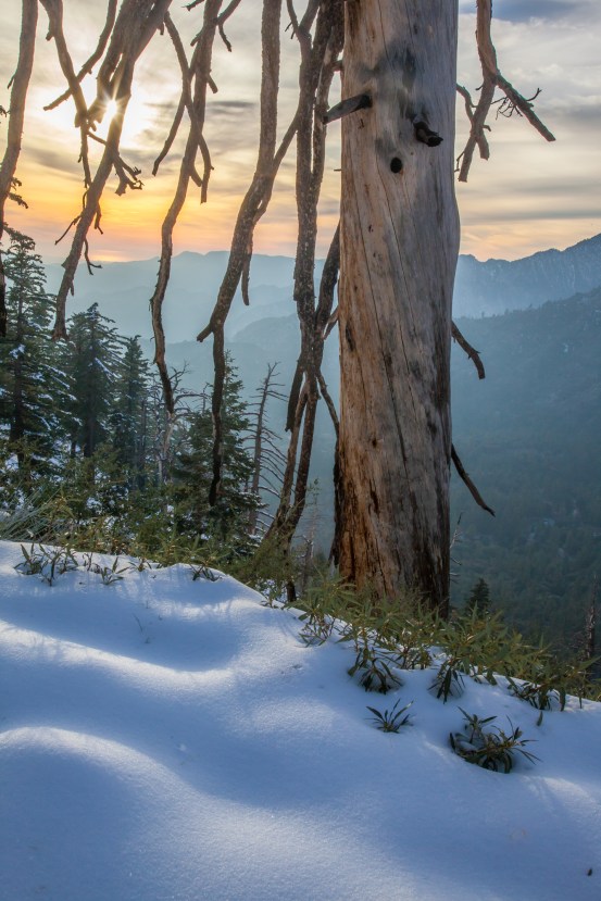
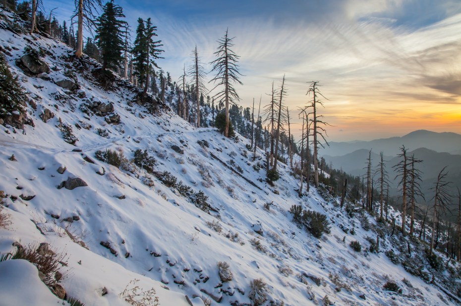
The PCT here is relatively flat in terms of elevation gain, but it is usually traversing a moderately steep slope. Depending on snow conditions it can be dangerous, so keep that in mind. The forest here is untouched from the Curve Fire, so for the most part our views were limited to the snow covered trees surrounding the trail.
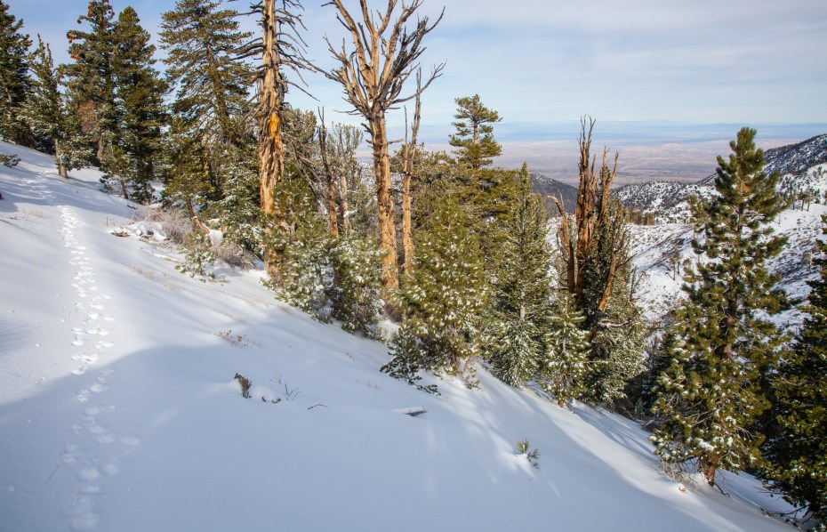
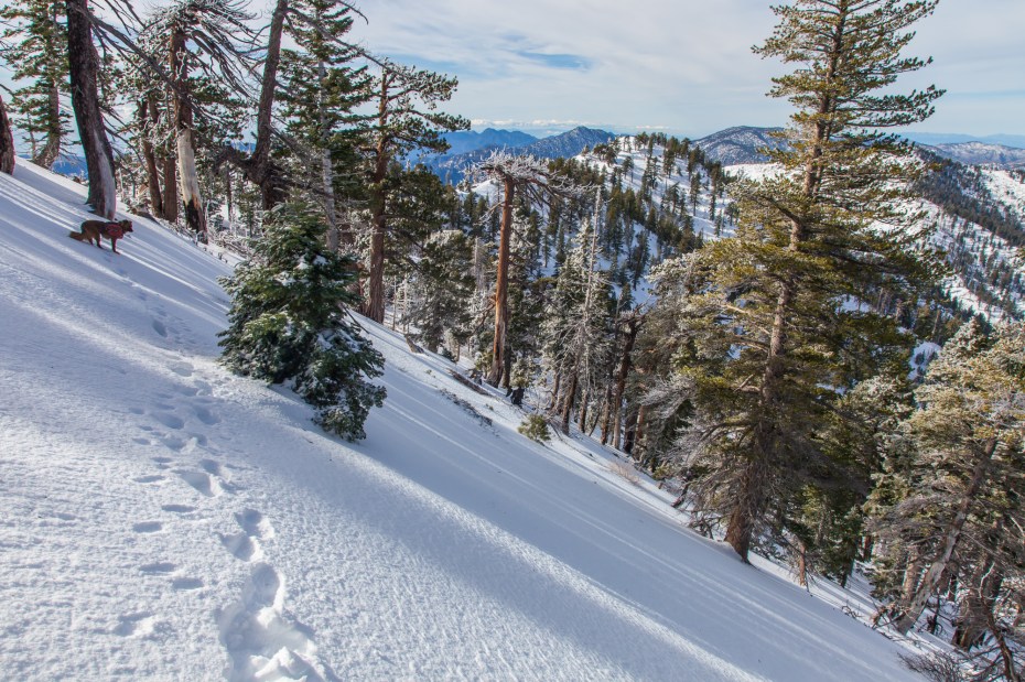
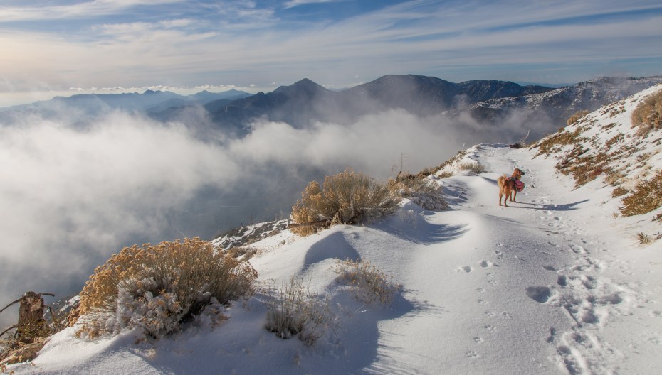
Occasionally views down into Antelope Valley open up through the forest, and in the distance almost every mountain range was capped with snow.
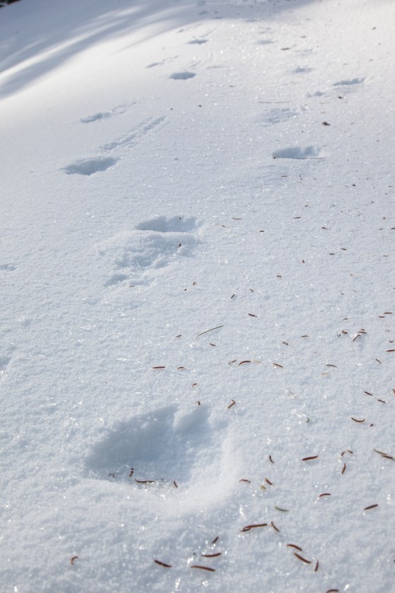
Throughout the day, I spotted different animal tracks that would join the trail for short sections. On this stretch of the PCT, I got to shadow a bear for a few hundred yards. One of the things that I love about hiking in the snow is that big animals that are normally stealthy can’t help but leave obvious signs of their presence.
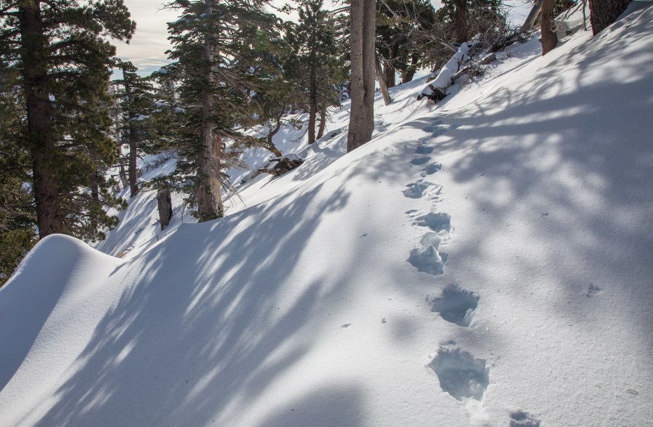
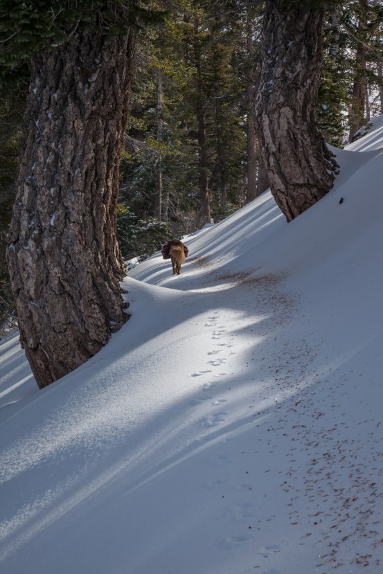
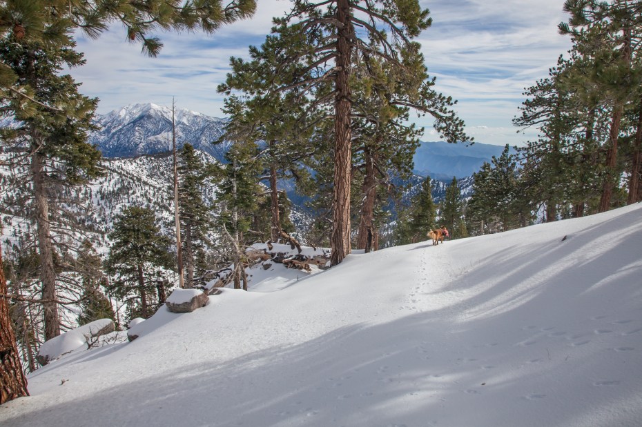
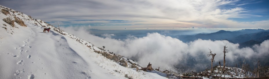
When we reached the junction with the trail at Hawkins Ridge, the hiker’s footprints that we had been following took a right onto the ridge trail. We continued along the pristine looking PCT, with Callie leading the way. Without any tracks in the snow, my progress became even slower and more tiring. I postholed down about a foot into the wet, heavy snow on almost every step, while Callie effortlessly glided on top of the snow. Snowshoes would have been a tremendous help here, but unfortunately I didn’t have any with me.
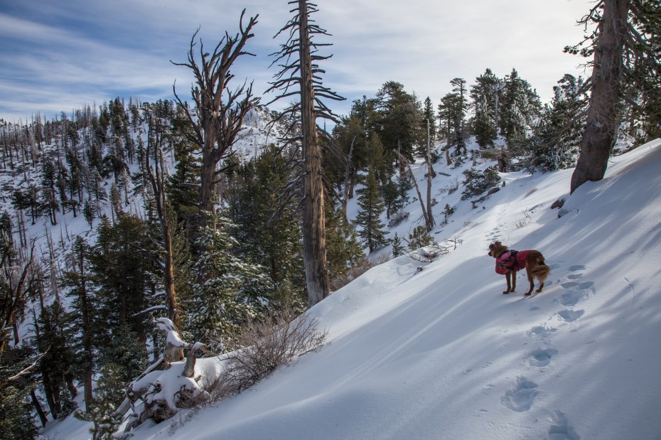
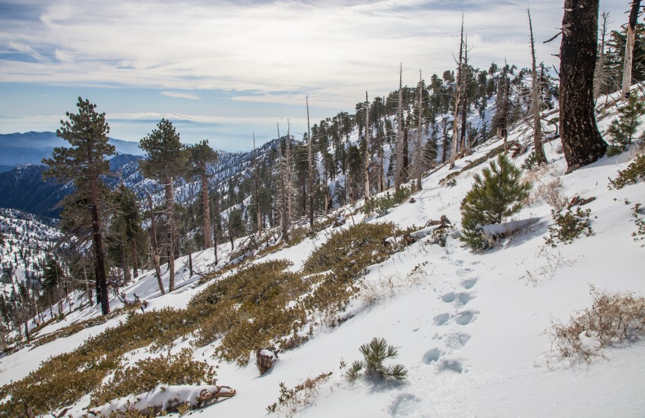
So, instead of going too much further up the PCT, we settled on going about a half mile up to Mount Hawkins, which would be our high point for the day. From the summit, we got our first glimpse into the snow covered eastern side of the San Gabriels. Our vantage allowed us to see most all of the highest peaks in the range in a clear line across.

Four 9,000 foot peaks from left to right: Mount Baden-Powell, Pine Mountain, Dawson Peak, and Mount Baldy.
After a short summit break, we retraced our footsteps back along the PCT to the Hawkins Ridge junction.
At the junction, we took a left towards South Mount Hawkins. Here we intersected again with the footprints that we had been following earlier, and I was grateful to once again take advantage of the previous hiker’s effort in breaking trail.
Then, a quarter of a mile into the traverse, the footprints stopped at a particularly steep section of trail and turned around. As I began to head across the steep slope with barely any trace of trail, a sense of doubt washed over me for a moment. Did the person that turned around know something that I don’t? Was I getting in over my head? At this point, we still hadn’t seen another person on the entire hike, and the wilderness out here is surprisingly vast and rugged. It’s not a good place to make a mistake. This is a recurring theme with our snow hikes, but it’s an important one to emphasize.
I pulled out my ice axe and moved across the steeper sections with deliberate focus. The snow was still very soft so I wasn’t that too concerned about sliding down the slope, but it doesn’t hurt to be cautious.
After a couple of steep sections, the trail mellows out substantially and we felt well rewarded for our efforts. This is a beautiful stretch of trail, especially after a recent snowstorm when Mount Baldy and the Sheep Mountain Wilderness have a dusting of snow. Walking through this pristine snow covered wilderness without any sound other than my feet crunching through the snow was one of the most peaceful moments that I’ve experienced on the trail.
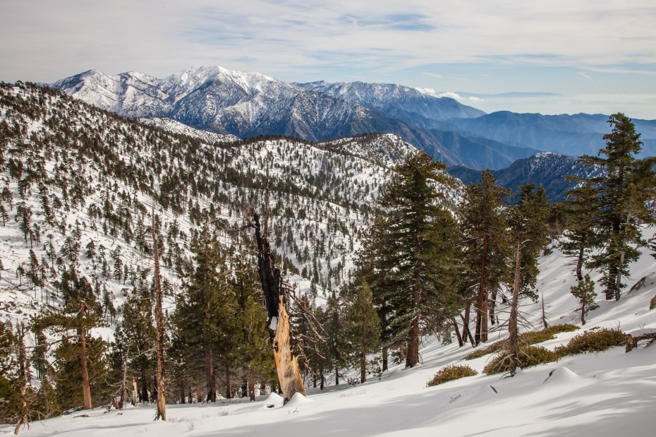
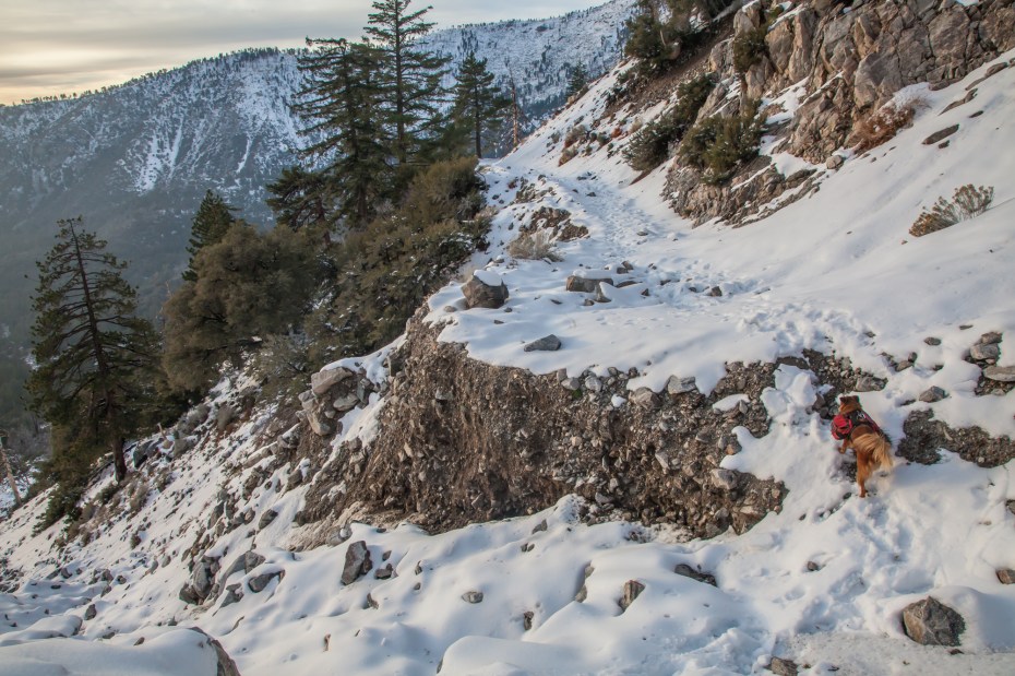
The traverse trail is a little over 2 miles long, and as we reached the end of it we got a great view of South Mount Hawkins and the ocean behind it.
It’s pretty remarkable that this can all exist in one frame.
The summit of South Mount Hawkins is reached by a fire road that intersects with the trail to Windy Gap, near the Crystal Lake campground. The ridge traverse trail intersects with the fire road about 300 feet short of its summit. Normally, hiking on a fire road isn’t ideal, but when everything is covered in snow, it doesn’t make much of a difference. Either way, the views up here are spectacular and it’s worth a visit for that alone.
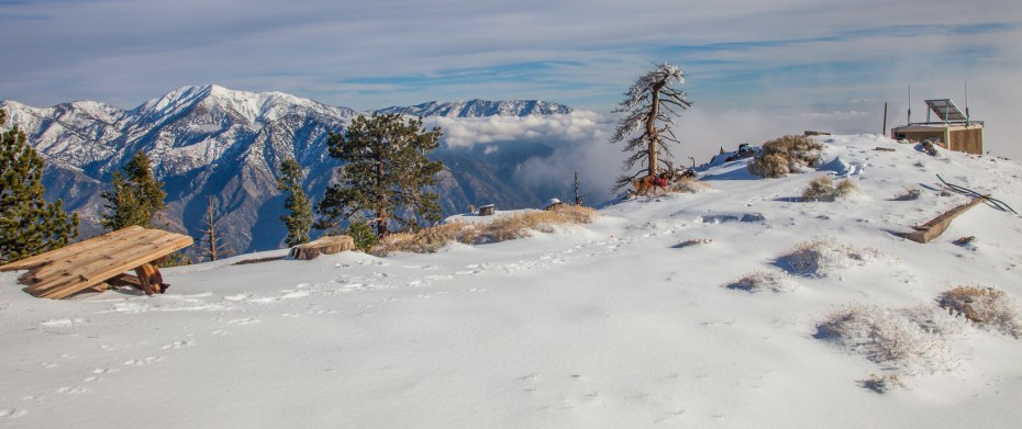
The top of the mountain features the remnants of an old lookout, which makes sense given its clear view down into the Sheep Mountain Wilderness. It also has an open view down to LA and the ocean, making it one of the best summit views in Southern California that I’ve seen.
Heading down from the summit, we had close to five miles left in our hike. The snow on the fire road was still deep enough to be a bit tiring to walk through, and by now my legs were wiped out from postholing through miles of snow. We took our time heading down and savored in the views as much as possible to compensate.
The views do not disappoint on this fire road, and I would highly recommend it to anyone who is interested in hiking in the snow but is cautious about it and/or does not want to purchase any gear. The one major downside to the road is that there are a few sections where flash floods have created deep washouts over the road. These are all passable, although I found one of them to be slightly sketchy. Other than that, the road is easy going.
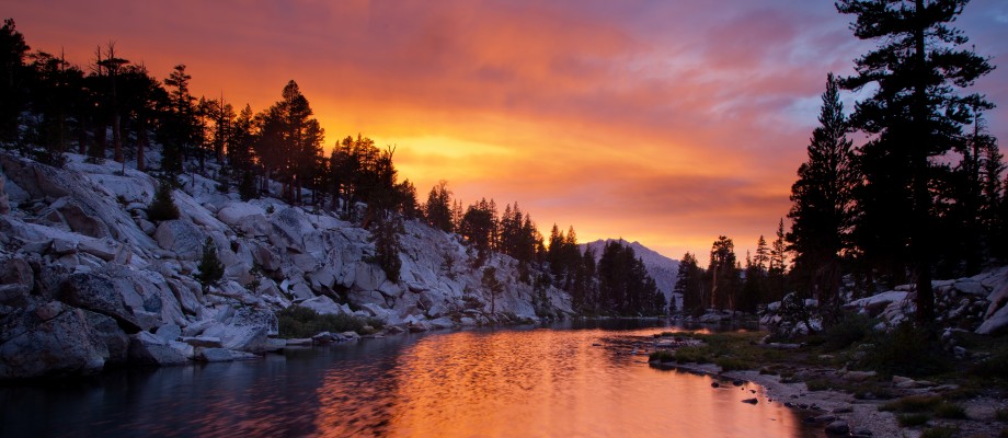
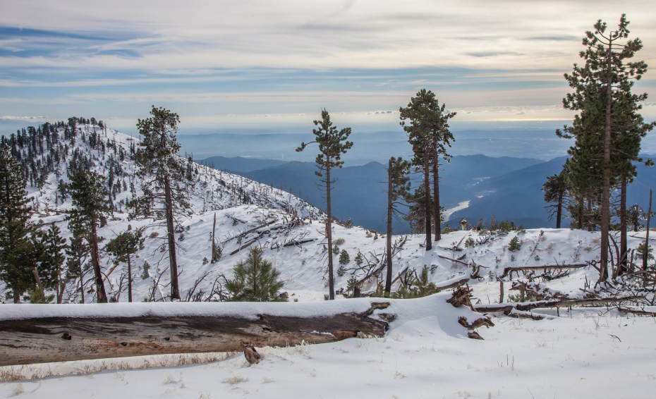
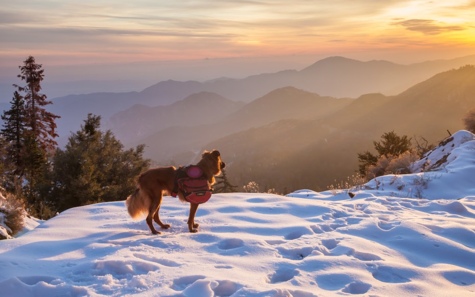
As the day drew near a close, we had one last moment of bliss as clouds over the mountains and ocean burst into color from the sunset. Callie found herself on a section of snow getting basked in the golden light just as the sun was dipping out of sight. The contrast of the ocean and snow mixed with the dramatic sky gave the scene an incredibly surreal feeling. This is what dog heaven must be like, at least for Callie.

Great write up and awesome pics!
Once again, GREAT photos! Thank you so much for sharing and allowing us to hike vicariously through you.
I’m planning a trip to Crystal Lake this Saturday and looking forward to taking my godson to “the snow” for his very first time. Though I’m in no condition to hike this trail, I’ll be in awe at the fact that I’m so close to it.
Great shots, and very enjoyable descriptions! I especially love the shots including the dog, with my favorite being the one where the dog is viewing the setting/rising sun. I also like the bear paw prints!
Not to state the obvious, but that looks like a pretty healthy dose of snow! Great shots too.
As always, great write up of your hike…and, your pictures just seem to get better and better. Thank you!
amazing photos!
Nice! I’ve lived in LA now for a combined 14 years and STILL rarely make it back into our mountains.
I’ve got to get up off my butt and do something about that.
Great photos! I’ll be watching the weather closely so I can copycat this trek!
Great shots………..we are so blessed in So Cal…..snow with an ocean view!!!
Pingback: Hiking the High Desert Loop | CaliTrails
snow shoes ?
Not on this specific hike.