
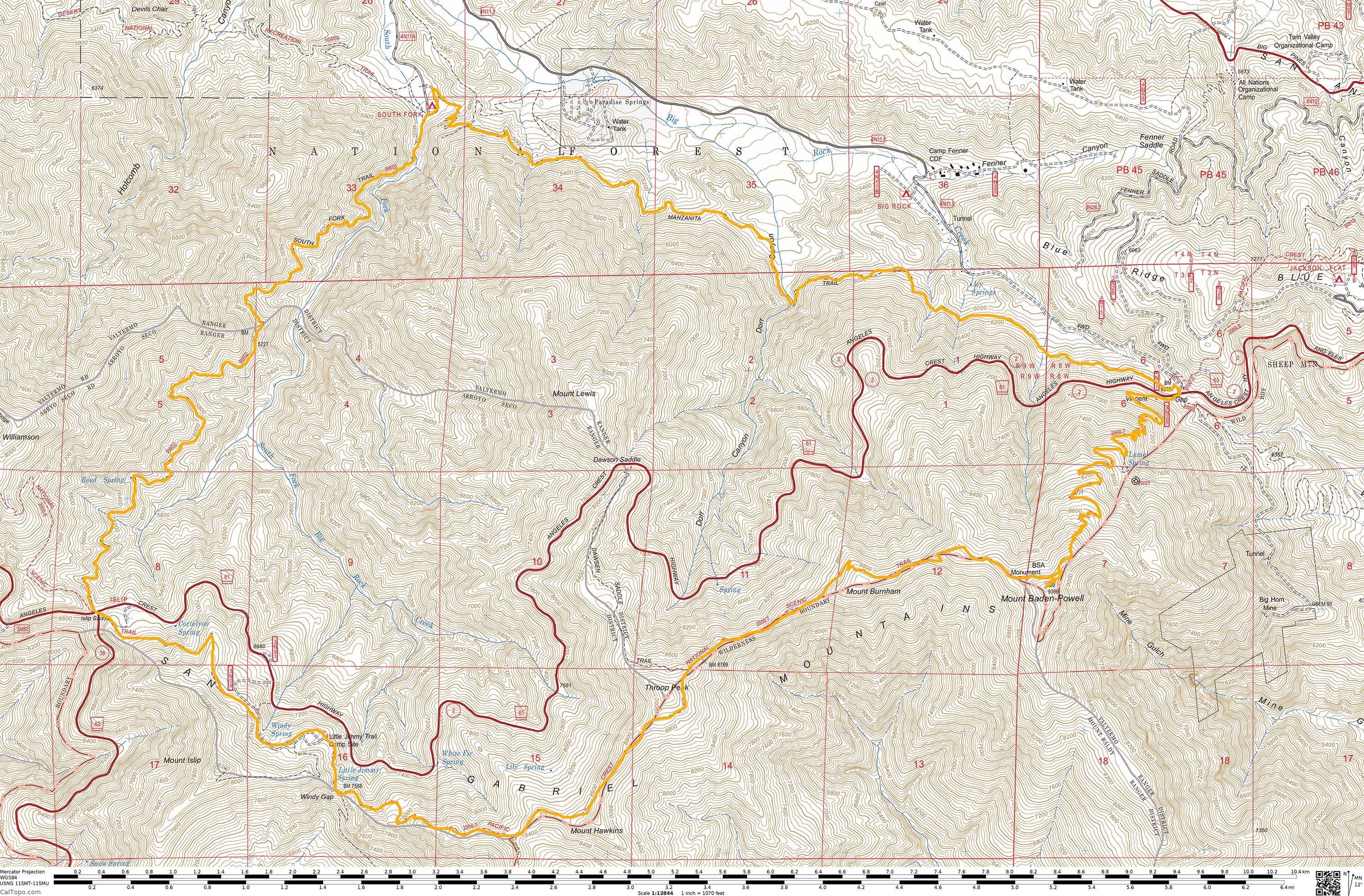
 This 23 mile hike connects three different trails together into an epic loop that showcases the variety of ecosystems the San Gabriel Mountains have to offer.
Trail Details
Mileage: 23 Miles
Elevation Gain/Loss: 6000 feet
Day(s) Hiked: 5/11/15
Trailhead Location: Vincent Gap
Alternate Trailheads: South Fork Campground, Islip Saddle
Dog Friendly: Yes
Intro
I spend a lot of time looking at maps, daydreaming about potential hikes. It’s fun to look at a system of trails as a puzzle, with the goal being to find the most appealing route. You’d be surprised at what you’ll find that hasn’t been covered in books and blogs such as ours.
This loop has been on my radar for a few years now, mainly because I have wanted to hike the South Fork and Manzanita trails, but the prospect of driving for an hour and a half just to do a simple out and back hike on one of them seemed like more effort than it was worth. When you are staring at a map, the two trails clearly connect with the PCT into a convenient loop, which looks quite inviting on a zoomed out map. The reality of the trail is a bit daunting though, so I only recommend this loop for experienced and conditioned hikers. The mileage and elevation gain and loss is almost identical to the Mount Whitney dayhike, and the lower section of the hike has some fairly exposed sections and the possibility of extreme heat in the summer months. Making timing even more difficult, the higher elevation parts of the hike are usually covered in deep snow during the winter months. That being said, we timed our trip perfectly and had a blast.
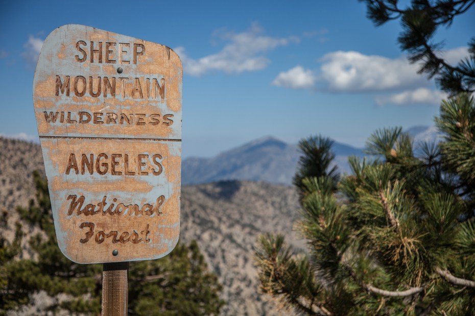
Also, some of you may be wondering why you’ve never heard of the title “High Desert Loop.” I made it up. It rolls off the tongue much easier than the Manzanita – South Fork – PCT Loop, or any alternate variation. The start of the loop is also the start of the High Desert National Recreational Trail, and the majority of the hike straddles the high elevation overlooking the Mojave Desert, so the name seems fitting. We’ll see if it sticks.
Trip Report
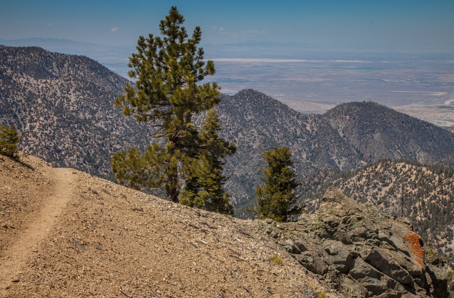
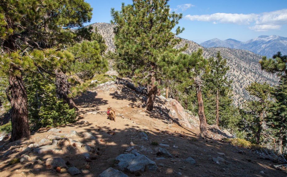
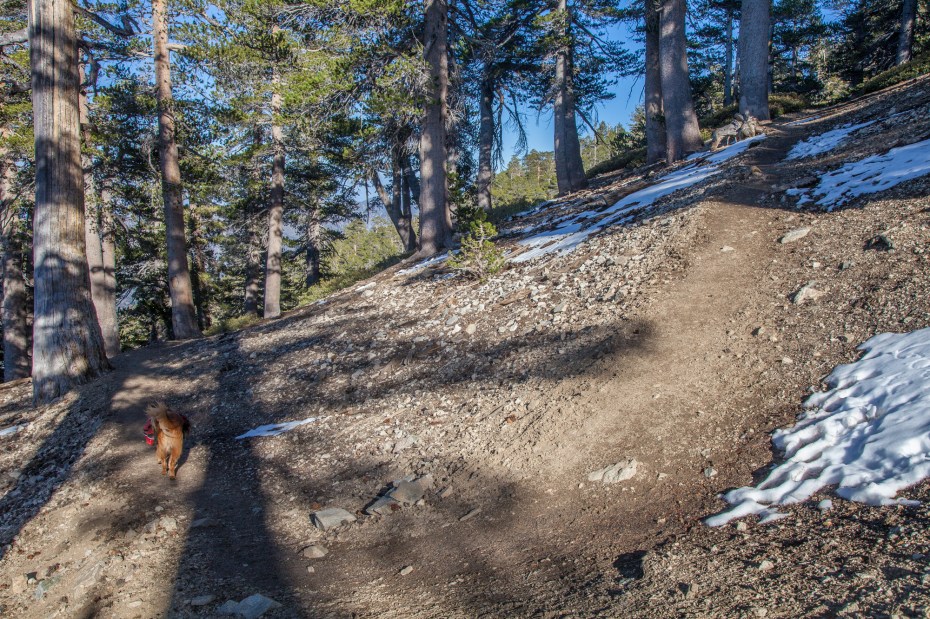
As I drove in the predawn twilight on an empty Angeles Crest Highway, I couldn’t help but fear that my goals may have finally exceeded my abilities. Callie and I were about to embark on an ambitious loop, which equaled the longest hike that I’ve ever done and easily topped Callie’s longest. Our training lately has been sporadic, so my confidence in my conditioning was nowhere near where it was when I tackled my Mount Whitney day hike, despite the nearly identical distance and elevation gain between the two hikes. On top of that, current information on the South Fork trail had been scarce, so I couldn’t help but feel a bit of trepidation as Callie and I embarked on our biggest day hike so far. 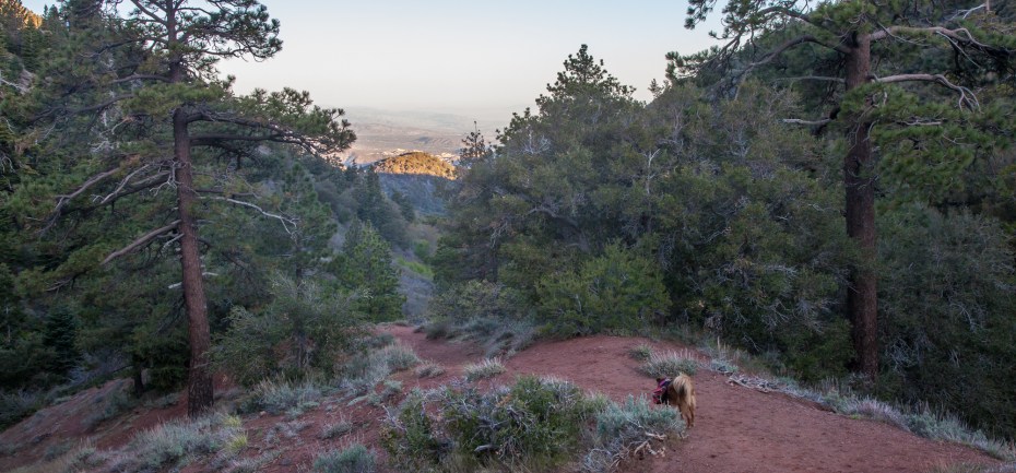 We started from the Vincent Gap trailhead shortly after sunrise and descended the Manzanita Trail towards the South Fork Campground. The trail starts out at a decent elevation around 7,000 feet up, so the initial part of the descent goes through some nice sections of pine forest that are common at the higher elevations of the San Gabriel mountains.
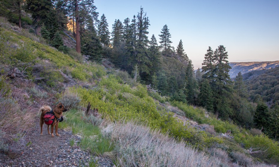
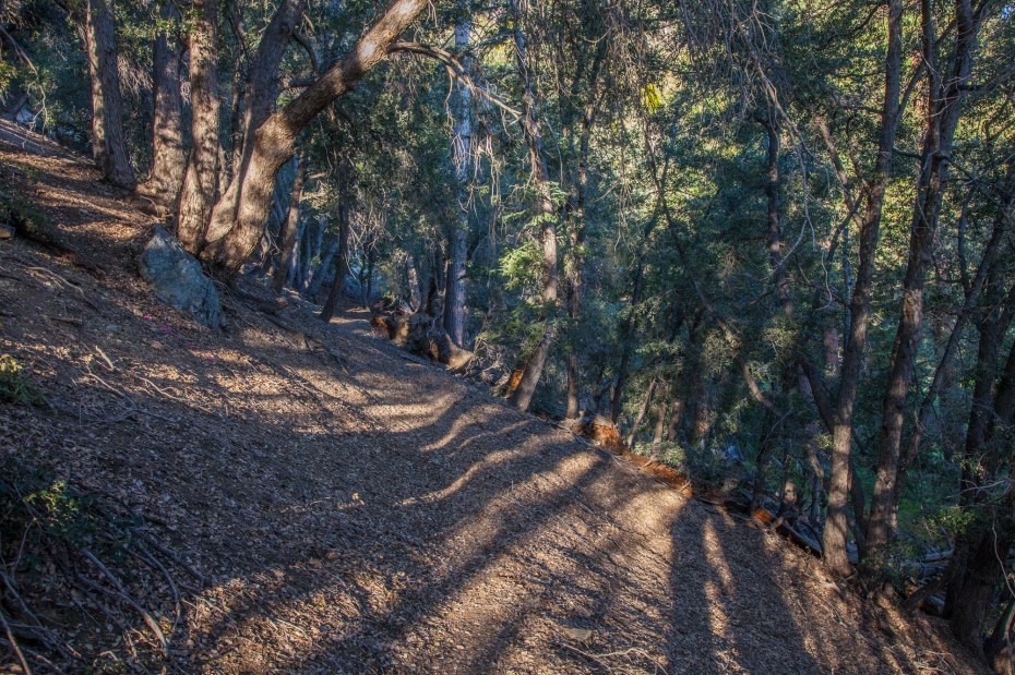
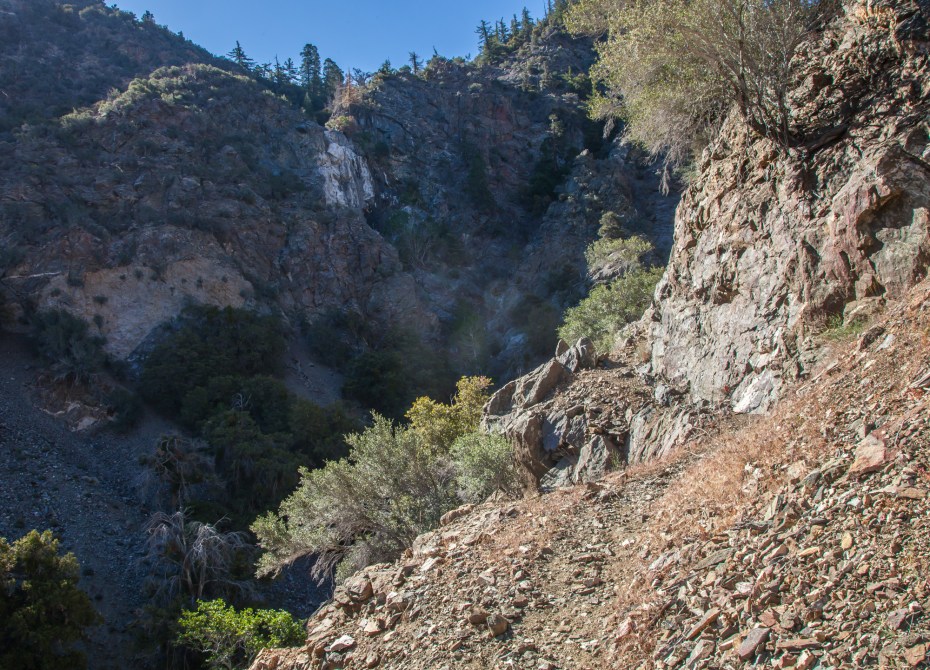
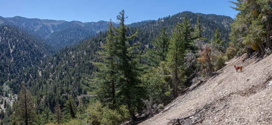
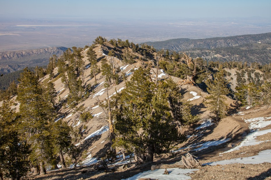
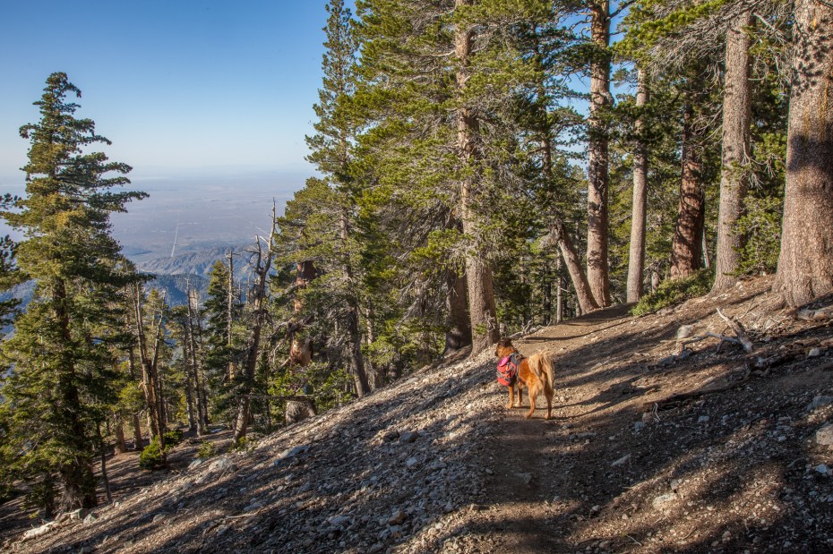
It doesn’t take long for the trail to reach a more arid landscape as it moves closer to the desert floor. Looking up the hill, the gradual thinning out of the forest is much more apparent which provides a nice visual representation of the transitions between environments that are showcased on the loop.

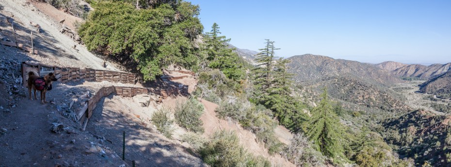
The views to the north of the trail also begin to open up which allows for fantastic vistas of the faultlines carving down the valley. The Devil’s Punchbowl is the confluence of a number of different fault lines, which is what contributes to the area’s unique geologic features. The Manzanita Trail runs parallel to two of those faults, the Punchbowl and Cocktail faults. The lower section of the trail is defined by clear views of the footprint left behind by these nearby faults, which gives it a unique flavor in comparison to the rest of the Angeles National Forest. It feels like a logical extension of the Devil’s Punchbowl Natural Area.
It turns out the trail was in great condition as well. It has clearly benefited from some recent maintenance.
The Manzanita Trail concludes at the South Fork Campground, which is another potential place to stage this hike from. From the southern end of the trail, the South Fork trail begins heading up the South Fork of Big Rock Creek.
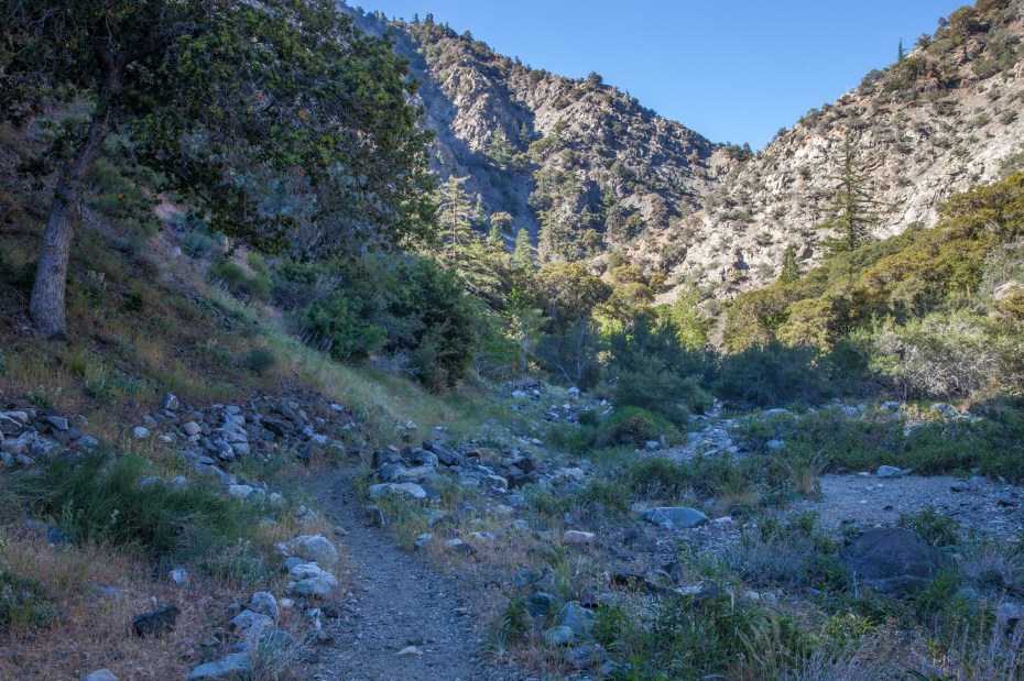

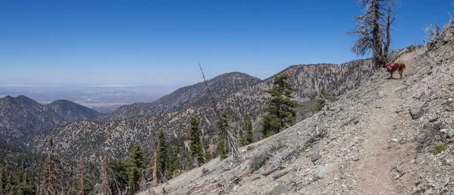
After a short distance, the trail crosses the creek, which was quite easy given the current drought conditions. The next stretch of trail is the most exposed section of the entire hike, and one of the more exposed sections of trail that I’ve hiked in the San Gabriels. We didn’t have any issues with it, but I imagine that some hikers might not be comfortable with some of the narrow stretches.
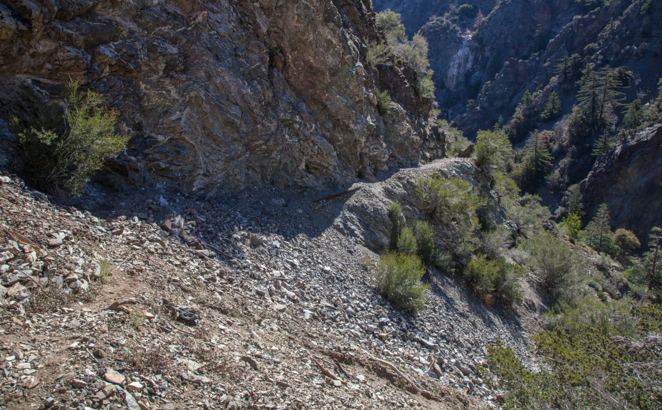
Fortunately, the trail eases up quite a bit after the first half mile and the rest of it was surprisingly well maintained and absent of any exposure to be worried about. There is, on the other hand no lack of sun exposure around here.
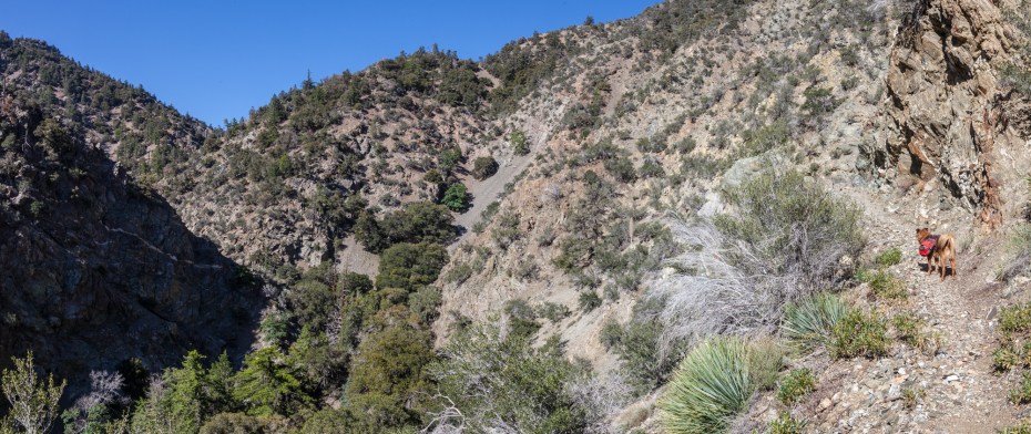
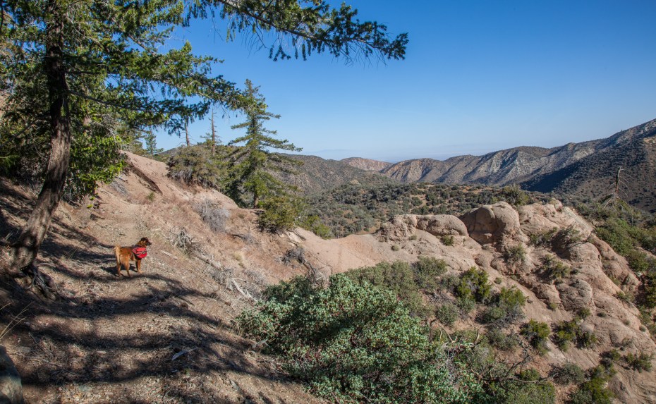
About halfway up, the canyon turns a corner and Islip Saddle and the remainder of the South Fork Trail come into view.

The hiking here is not especially scenic, at least in comparison to most of the places we visit. You won’t be seeing any postcards from the South Fork Trail. However, there is a palpable sense of solitude out here on the trail. The terrain is extremely rugged, and in the middle of the canyon it feels quite remote. There isn’t a sign of civilization in any direction for miles, despite being on the border of LA. The trail feels very similar to the Burkhart Trail in the Pleasant View Wilderness, a trail that we enjoyed recently.
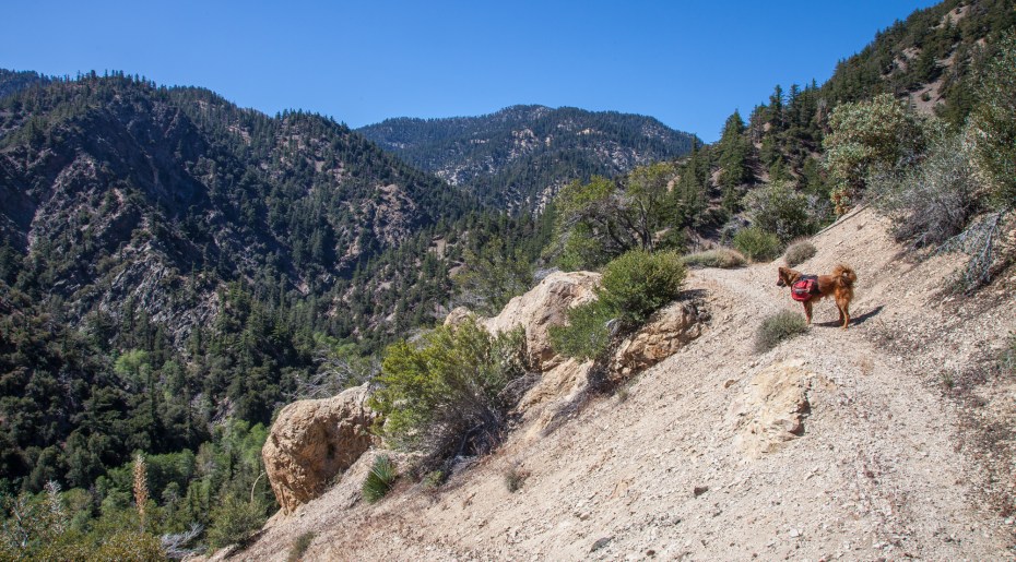
We tried to maintain a fast pace on our ascent to get back to the lower temperatures of the high elevation before the heat of the day set in. Our quick ascent of the South Fork trail dispelled any concerns that we were unprepared for the hike, and we quickly found ourselves at the Islip Saddle trailhead, already close to the halfway point of the hike.
From here, we hooked up with the Pacific Crest Trail which we followed back to our car at Vincent Gap. This is a classic stretch of Southern California trail. We’ve featured sections of it in our Dawson Saddle and Mount Hawkins Loop posts, but this was our first time hiking the entire stretch together in one piece. It’s pretty spectacular, so I recommend doing it as a shuttle hike if the idea of doing this loop feels out of the spectrum of possibility.

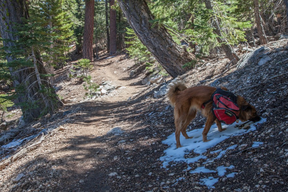
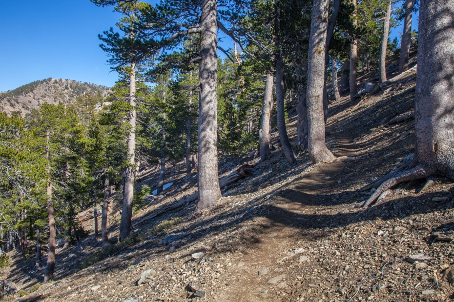
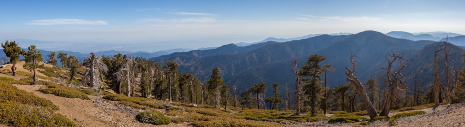
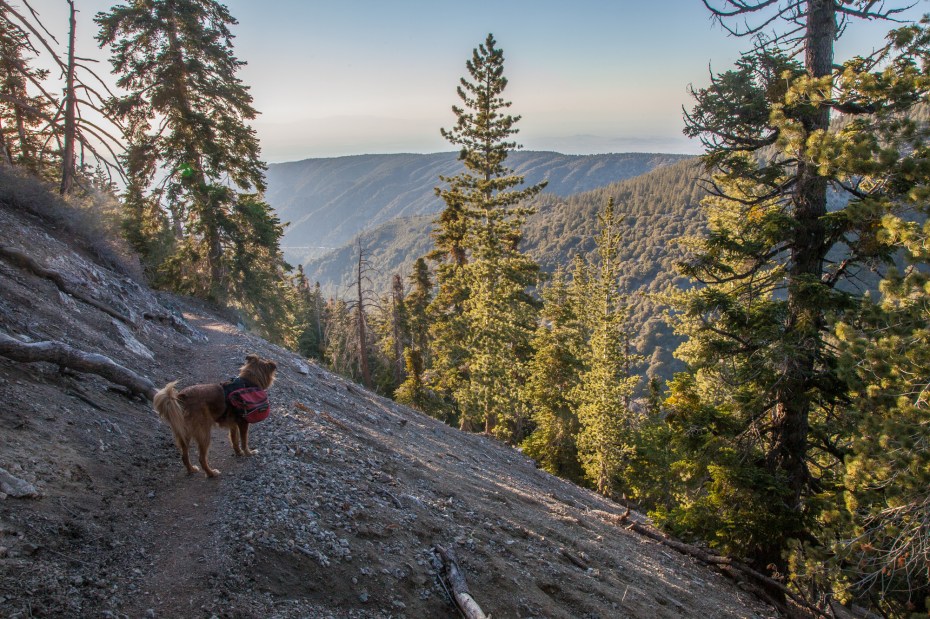
The PCT on the stretch to Little Jimmy Camp is a strong contrast to the route that we had hiked leading up to it. The sun baked desert trail segues into a serene forest scene. Scattered patches of snow from a recent storm further accentuated the rapid transition of ecosystems at this point in the hike. The trail also stays relatively flat as it straddles the crest of the San Gabriel mountains. All of these elements combined together made this stretch of the hike exceedingly pleasant.
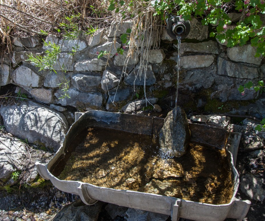
After a couple miles on the PCT, we reached Little Jimmy Camp, which is a popular backcountry campground near the summit of Mount Islip. Nearby the campground is Little Jimmy Spring, which is one of the only reliable water sources in the San Gabriel high country. We took a short break here to refill our bottles and talked with some PCT hikers also taking advantage of the spring. They were the first of many PCT hikers that we would chat with throughout the day.
The stretch of trail between Baden Powell and Little Jimmy is normally pretty empty, but during the height of thru hiking season it is bustling with backpackers. We were hiking against the grain and ran into about 40 of them between Islip Saddle and Vincent Gap. I thoroughly enjoyed the experience, since it allowed me to let some of the excitement of their adventures rub off on me. I think a section hike is in our future.
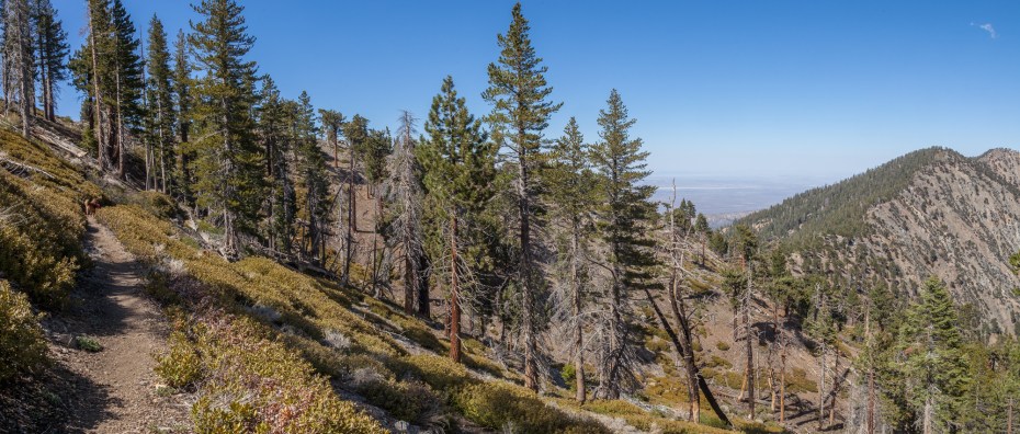
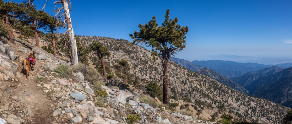
Little Jimmy Spring is only a few steps away from Windy Gap, which is a four way intersection of trails and a great viewpoint into the Crystal Lake basin. The last time we were here was on a beautiful snowy day, on one of the most fun hikes that I’ve ever been on. We normally prefer to hike this area in the winter, but it works well as a summer hike too. Windy Gap is about 7600 feet high, and as the PCT heads east it is able to remain above 8,000 feet for around seven consecutive miles. It’s a great place to beat the heat when the city below wallows in summer heatwaves. The elevation difference this high up will shave 20-30 degrees off daytime highs from LA, which can make almost any summer day bearable up here.
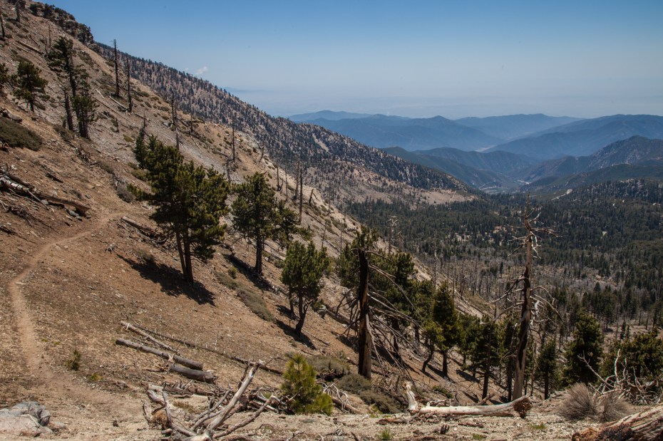
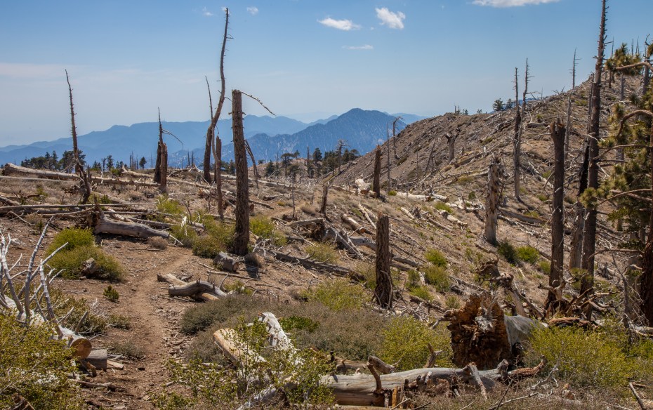
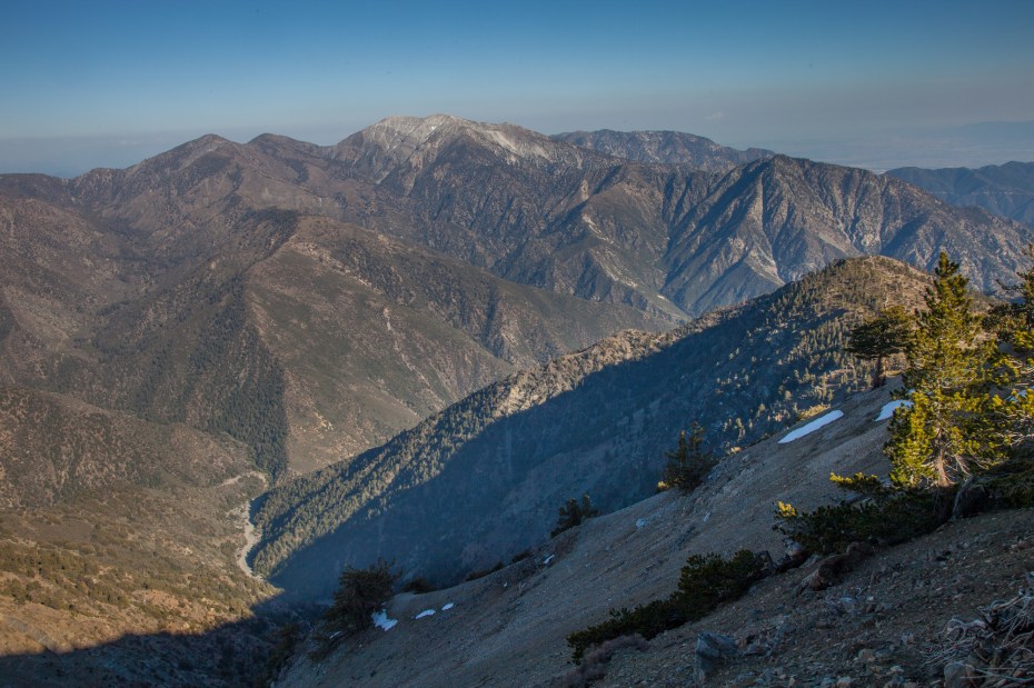
After the PCT leaves Windy Gap and heads east along the San Gabriel Crest, the shade that we enjoyed leading up to Little Jimmy Camp is traded for more sun exposure and open views. The trail alternates between views of the Mojave and the Sheep Mountain Wilderness backcountry, while it also moves between areas damaged by the 2002 curve fire and healthy sections of forest.

Mount Hawkins, Throop Peak, and Mount Burnham comprise a series of 8,000 foot peaks between Mount Islip and Baden Powell that you can easily add to the trip if you are into that type of thing. We’ve been on the summit of each of them already, and our trip for the day was ambitious enough as is, so we skipped them this time.
On this trip, our experience crossing the ridge was not exactly the kind of hardcore hiking story that you’ll read about in most peak bagger’s trail logs. I was suddenly overcome with a wave of exhaustion, but not the type that I was expecting to hit me 15 miles into the hike. My body still felt surprisingly good given all of the terrain we had covered, but for some inexplicable reason I became incredibly drowsy, to the point where it became increasingly difficult to proceed with the hike. I tried to power through it and eat some food to give my body a burst of energy, but it was of no use. I had to take a nap.
When I was planning out this hike and trying to make sure that everything would time out properly for such a big day, I had never anticipated this unusual turn of events. Part of the fun of going into the wilderness is the need to be present, flexible, and willing to improvise, so we rolled with it. I found a nice shady spot with a gorgeous view of Mount Baldy, set my alarm for twenty minutes, and then drifted into a half awake state that was just enough to recharge my batteries. We resumed the hike with renewed energy and spirits, and I was thankful to be able to fully take in the area’s beauty again as we headed down the trail.
Callie seemed to benefit from the break as well. She was still exuding pure elation despite approaching a new personal record for the longest hike of her life.

As I mentioned earlier, this stretch of the PCT feels relatively flat as far as trails around here go. The trail gains about two thousand feet between Windy Gap and Mount Baden Powell over the course of 5.7 miles. There are a few stretches where the trail loses elevation that it needs to regain later, so the total elevation gain between Windy Gap and Baden Powell is over three thousand feet. The most offensive stretch is the saddle between Throop Peak and Mount Burnham where the trail drops down well over 500 feet of redundant elevation.
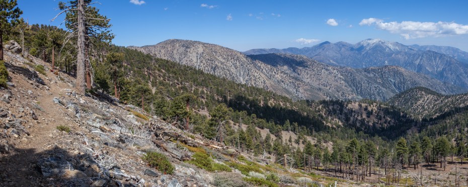
 At this point, the trail switches to the desert side of the range, and the final stretch towards Baden Powell reveals itself. The trail continues to alternate between intimate forest scenes, sweeping views of the Mojave, and rare vistas into the Sheep Mountain Wilderness.


The final stretch to Baden Powell is a short detour off the PCT with about a hundred feet of elevation gain.
 The views from the summit are expansive, which is why it’s a very popular mountain for southern California hikers.
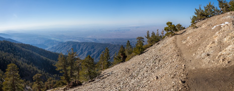
 Returning back to the PCT, we started the final 3.5 mile stretch back to our car at Vincent Gap. The faultlines that we hiked along earlier in the day were in plain view, and they seemed so far away in the valley below. At this point, we finally had the proper perspective to appreciate how big of a hike we had just done.
The portion of the PCT between Baden Powell and Vincent Gap is one of the most popular day hikes in San Gabriel high country, and yet, this was our first time on the trail. I understand why it’s so popular now.
Like the section between Islip Saddle and Little Jimmy Camp, the trail here is consistently shaded in an evergreen forest. This is a very nice area, and we’ll have to come back some other time to experience it some more, because at this point I was focused on getting back to the car while we still had some light left.


We pulled it off. The final stretch of the hike was completed in the beautiful golden hour, and we were back at the car early enough to get home for dinner with family. Even with an unplanned nap!

Nice write up and a great overview of the hike, thanks!
Thanks!
I’ve got an older lab who loves water and is good for about 6 miles. Any suggestions of how we might do a portion of this hike on those terms? Thanks,Stephanie and Porter
Hey Steph,
First of all, this area is general is quite dry, so it’s not a good place to take your dog to play in the water. Usually the front country hikes like Switzer Falls or Chantry Flats are good bets for that type of activity.
Regarding doing a short part of this hike, I recommend hiking Dawson Saddle to Throop Peak and if you are feeling up to it, hop over to Mount Hawkins on the PCT for an optional addition.
wow! epic journey there! done the good majority of this in sections-but this peaks my interest in tackling your ‘High Desert Loop'(backing the name too) what map do you recommend for the San Gabriels?
i get so spoiled with the good Harrison maps..not sure if they do one for the San Gabriels..again, thanks for sharing!
Thanks Brett! I have good news for you too. Tom Harrison has maps for the San Gabriels, which is what I use. There are two of them, one is called Front Country and one is called High Country. The High Country map is the eastern half of the San Gabriel mountains and is the one you’d want for this loop. Caltopo.com is also great for just researching at home.
Hi again,
Five of us were hiking in the San Gabriels near La Verne on Christmas day about seven years ago. My Wife’s family is from that area. We were looking out at Los Angeles when my sister in law said, Look at the two “Bobcats” behind us. When I turned around I saw a mature and adolescent Mountain Lion that had been following us. I was glad there was five of us. My brother in law had mountain biked this area all his life and never had seen mountain lions.
How much water does your dog drink during your hikes?
Tough to fully say since she drinks out of creeks/rivers/lakes quite a bit. Probably about 2/3rds of what I normally drink. She drinks a lot more when it’s hot out.
My buddy and I will be taking the same as you this weekend. We will however, take 2 days. Looking forward to the hike and thanks for all the info you posted. Your posting is why we chose this hike. Thanks again
Hi, thanks for posting. I’m doing a multiday from Crystal Lake up the PCT over to Baden Powell, down the Manzanita Trail, into the Devil’s Punchbowl, up to Burkhart Saddle, over to Islip Saddle then back to Crystal Lake. Where did you get that jpg map you have at the top ? Or how did you make it ?
Nice dog
Caltopo.com
Thanks. Went out last weekend before checking it out. Somehow missed the Manzanita trail, went down a fire road…ended up outside a prison. That was weird. Eventually got to South Fork campground. Had a full pack and still need lots of conditioning so basically end up doing your loop instead, starting at Islip Saddle Saturday evening, camping near Little Jimmy, then heading east toward Baden Powell etc next morning. Hikers beware, when I got back to my car on Monday there was lots of shattered glass in the Islip Saddle parking lot. Multiple car break ins. Mine was left alone. I don’t keep anything up front (and keep very little of value in the trunk).
Started playing with CalTopo when I got home, very useful.
Hi! I love this trip write-up. I too have done the Whitney hike in one day and this sounds awesome to do that way as well. But I’m thinking I’d like to stretch it out a bit for the backcountry experience and for getting friends to come with me. They thought I was a bit insane when I brought them on what is now known as the 22 mile,14 hour death march from hell so I need to win back their trail trust. They all made it to the top though so it’s not like I didn’t train them well first 😉 Also, we would bring our dog on this trip and 23 miles in one pop might be a little much for him. Is this a good backpacking loop with good/legal places to set up camp? I’m thinking October. Thanks for any advice! Jen
Yeah, there are a few places you could camp here. You can camp at a campsite down in Lancaster Valley which is the lowest point of the hike, and you can camp at Little Jimmy camp near Islip Saddle. Both places are some of the only spots you’ll have access to water as well.
Thanks for the photo guide, we started this loop from South Fork Campground and missed completely the climb in elevation out of the creek bed. We ended up going 2.5 miles down the banks of the creek, constantly looking for a way up to the left. Frustrated at the lack of signage on the South Fork trail outside of the trailhead especially because there’s a lot of debris and rock slides causing confusion in where the trail goes. Would want your readers to know there’s high likelihood that the same thing could happen to them.